How to Create AMDB
GoSoft, the market leader in Indian aviation information, applies proven expertise and resources to enhance safety and operational efficiency on the ground. GoSoft’s Airport Mapping Data delivers more detailed and dynamic information through a 3 step data layering approach described below. Finally, all created data is subjected to rigorous validation including quality assurance and control procedures.
Geo-Reference Satellite Imagery
High resolution satellite images are captured over the airport and provided to GoSoft. These images are geo-referenced with the use of very precise ground control points.
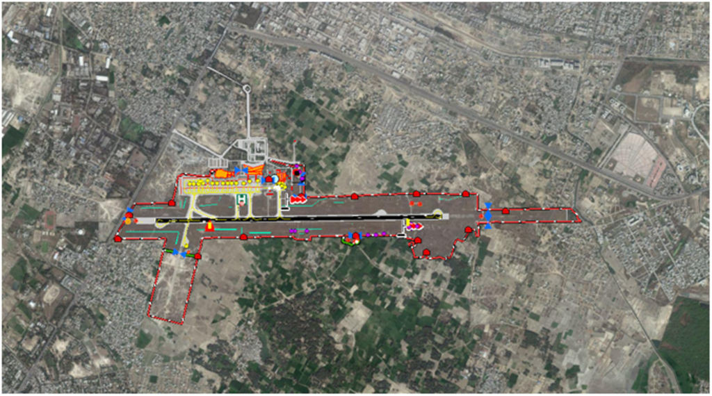
Digitize Feature Classes
Imagine that the raw data comFeature classes are digitized from the geo-referenced image. These features consist of runways, taxiways, aprons, shoulders, buildings, etc. (See RTCA DO-272/EUROCAE ED-99 for all the supported AMDB feature classes.)ing fast and furious from many sources is the foundation of your big data strategy. This data is saturated with geographic elements that you’re probably not using. Geographic tools help you filter and convert those elements into geographic layers of information. You can analyze those layers to create new, more useful maps for decision making.
Aerial View of AMDB
Benefits of AMDB
Global Aviation Challenge
Our AMDB serves two main purposes. First it is a highly accurate and detailed map of aerodrome features. Second, the database contains elevation data of the local terrain and obstacles which is crucial information for airport planning activities. These databases are created using GIS software to extract 3D features in point, line or polygon format as layers inside GIS databases.
GoSoft's Solution
GoSoft’s AMDB provides clear advantages over alternative solutions. For example, CAD and As-Built diagrams do not provide the geospatial accuracy and intelligent data that are inherent with GoSoft’s AMDB. These older solutions do not provide the geospatial accuracy and analytic capabilities which are now required for new airport and aeronautical applications. In addition, GoSoft’s AMDB is geo-corrected to an earth-centered reference frame, eliminating the need to rely on local reference systems.
Why GoSoft
GoSoft maintains the industry’s most rigorous validation procedures to ensure the accuracy, timeliness and reliability of our airport mapping database. In addition, we employ a dedicated team of experienced professionals to monitor, verify and communicate modifications to the geospatial dataset.
At GoSoft, we also continually pursue opportunities to enhance our data and deliver additional value-added services that contribute to even greater safety and efficiency on the ground. In addition, we continually identify and explore new ways to expand our airport solution offerings to support your current and evolving needs.
GoSoft puts large amounts of aeronautical information to work for you. Our comprehensive database works in conjunction with your airport applications and systems, supplying a wide range of fully integrated information. This comprehensive information allows you to easily and cost-effectively enhance the capabilities of your ground-based systems, without diverting valuable resources from your organization’s core competencies. GoSoft also performs routine database maintenance and updates to ensure you are working with the latest information.


